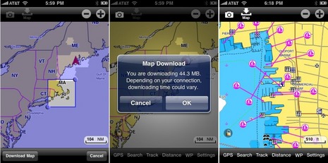
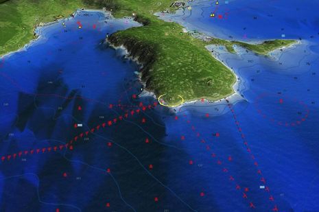
I think it's safe to presume that Navionics Mobile Marine is the best selling iPhone charting app in the U.S. and many other countries. In fact, as I just wrote in an April Yachting article, many iPhone boaters consider it a "no brainer" even if they also use other nav apps. But lookee here, they've rebuilt the entire thing, substantially improving both features and value. Today you can buy the US East Marine and East Lakes versions for $10 each, a steal really, but they are 166 and 535 megabyte files, which is a bit of an inefficient pain for all concerned. By contrast, the new $10 Marine&Lakes:US will be an easily updated 2 MB because it doesn't come with data. BUT you'll be able to download charts and lake maps for anywhere in the entire U.S., quite easily, and fresh direct from Navionics' own servers. The greedy download illustrated above -- note the chart and POI detail of Newport -- took about 10 minutes via my home WiFi network, and a much smaller download went fine even over AT&T's poky Edge service. And there's more...
When MaxSea bought Nobeltec from Jeppesen last Fall, there were hints that one somewhat counter-intuitive result might be a new partnership between Furuno/MaxSea and Jeppesen, but I didn't think we'd see results this quickly. Today Furuno announced that NavNet 3D displays will soon support a worldwide portfolio of "C-Map by Jeppesen" MapMedia charts, in addition to the NOAA raster and vector and "Datacore by Navionics" MapMedia charts they already support, thus making them "the most versatile" chart plotters available. It sounds great, but there are some details to note...
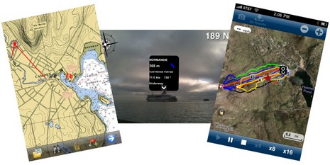
The tidal wave of interesting iPhone boating apps rolls on! The screen at left above (click for bigger) shows a beta version of Memory Map's upcoming charting app and I can tell you that it already handles NOAA raster charts and topo maps with speed and smoothness I didn't think possible on plain 3G hardware. At middle is the brand new Ships Ahoy!, a $3 AR (augmented reality) relative to Ship Finder and the other AIS viewers that lets you just point an iPhone 3Gs (you need the compass) toward a vessel or two to get their names and details (if the area is covered by a network receiver). And finally there's Navionics' neat new Ski:US, which admittedly has nothing to do with boats but does speak to this big marine company's big commitment to mobile apps. It happens to have my local Camden Snow Bowl among the so-far-limited ski area coverage, and it works great. In that screen shot I'm playing back the tracks (in yellow) I cut right after last week's big snow dump, in particular the --- MPH moment I lost board control in a huge drift. All these possibilities, and lord knows what else, will expand if Apple introduces a 4.0 version of the iPhone operating system this afternoon. But of course the bigger questions swirl around the Apple tablet, or whatever they decide to call it...
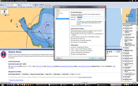
One thing I've always liked about Coastal Explorer is the way it handles points of interest (POI) information. It includes a vast, searchable gazetteer, along with coast pilot info that gets listed and icon-located when you're checking out a harbor ("places" tab). Plus it integrates Panoramio community photos if you want and Maptech marine facilities and port photos if you have them. (CE 2009 did not become Maptech Chart Navigator Pro 2009, unfortunately, though CNP, which is actually CE version 1, is still being sold as "new" software, also unfortunate.) You can see in the Options box above how Rose Point is working on an automatically synchronized Community Guide Book idea that has terrific potential. But, whoa, check out the new "Subscription" options that will appear in an CE update very soon. Rose Point has struck an interesting deal with the Atlantic Cruising Club guide folks, and thus CE users will get free partial ACC marina listings -- like the Wayfarer data above -- for those guide areas shown. They'll also get a neat way to integrate complete ACC guides into CE...
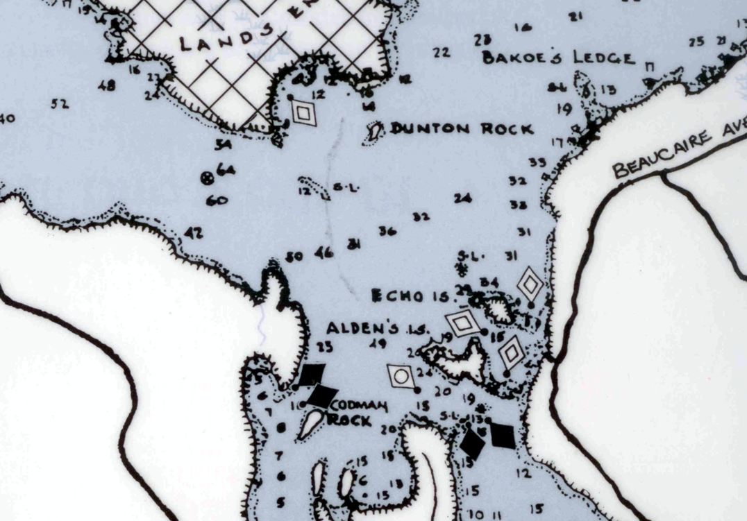
Tim Thurston earned that grin. We were out on Lake Megunticook randomly comparing the digital map I helped Navionics make last fall with the survey work Tim did for his little Maine Lake Charts company at about the same time. And while that little islet in the background is on the beautiful MLC paper map Tim made, and on that Garmin Etrex he managed to put his digital data on, it was completely missing from the Navionics map! While this is a shallow and somewhat out-of-the-way spot I steered us to -- and both maps are way, way better than what was available until to this summer -- I tend to think that Tim got the details better. Unfortunately boaters can't make best use of those details just yet...
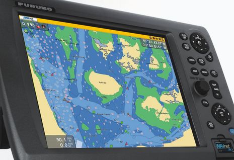
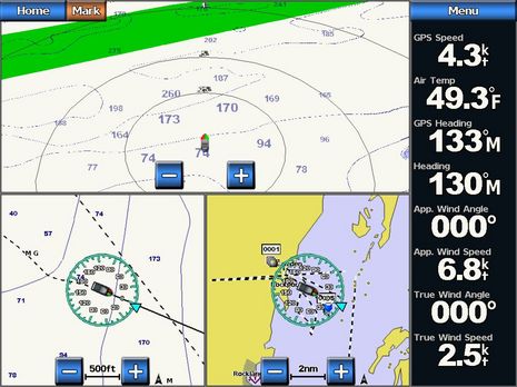
This entry's title is not about cause and effect; my wind sensor testing may go incomplete, but that has nothing to do with Garmin's chart problem. And while I had a good time on the water yesterday, even if frustrated by details, the mood in Kansas seemed a bit morose. Imagine the satisfaction of introducing all the free and amazing enhancements in Garmin's 5.0 marine software (which I was enjoying immensely, as seen above), but then just a few weeks later realizing that there was a processing error in the creation of new and improved Bluecharts that was potentially so bad that you had to recall all the 2009 chart cards sold so far around the world. Ouch!
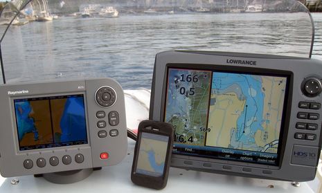
The photo isn't fair, because the shooter (me) is reflected in the Raymarine A57D's screen and the iPhone is in an Otter Box which includes a screen protector that muted its display in a way I don't notice in normal use. But there's some truth here, too; the screen on the Lowrance HDS 10 has been bright, crisp, and completely readable in all light conditions so far experienced on Li'l Gizmo's completely exposed helm, whereas the other two have sometimes been quite hard to read. Another truth is...
I don't usually write about rebates and sales, but 90% off!?! Navionics not only launched version 2.0 of its Mobile app yesterday, it's slashing prices. Here's the press release, and note above how the whole Gold USA East chart portfolio dropped from $50 to $5. Apparently all the chart region prices will follow -- at least to some degree (British Columbia now $10) -- in the next few days, and stay bargain priced for "a limited time this summer." A month ago I noted how fast iPhone/Touch navigation is moving, and it hasn't slowed down...
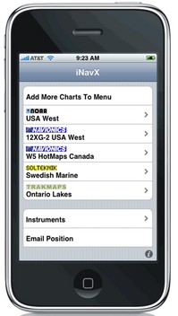
Wow, isn't an interesting crowd of chart, map, and data suppliers gathering rapidly around the iPhone/multi-other-platform X-Traverse service? I recently discussed the velocity of this and other iPhone-related developements, but was still surprised to learn today that Navionics is officially on board (Americas charts and U.S. Hotmaps available now, the rest of the world portfolio coming "in the next couple weeks"), that Hilton's Realtime-Navigator fishing overlays will go up on X-Traverse in May, and that "agreements are in place with several other chart manufacturers to bring expanded coverage and choice (raster or vector)."

