Garmin GTU 10, a remote anchor watch?

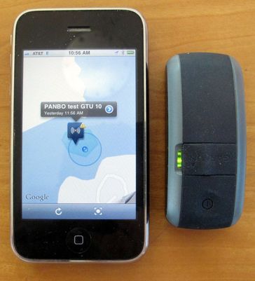
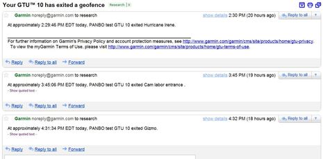
I'm pretty impressed with the Garmin GTU10 I've been testing this summer. Inside that little IPx7 waterproof case is a sensitive GPS, a GSM cell modem, and a fairly able lithium ion battery. For $200 you get the hardware, a cute case (meant primarily for hanging on a dog collar), and a one year standard data subscription which normally costs $50. The subscription doesn't get you much in terms of remote tracking -- just the last ten points, whose spacing will vary with settings -- but you do get unlimited notifications about when the GTU 10 enters and/or leaves up to 10 geofence areas that you can define at mygarmin.com, or with the free Android and iOS Garmin Tracker apps. And aren't geofences the key to knowing that your boat or tender are where they're supposed to be, especially when anchored?...
Well, Garmin didn't really design the GTU 10 for anchor watch duties, but it's useful nonetheless, and a tweak or two might make it near perfect. The problem is that the maps you build a geofence on are not charts and also your current position doesn't show on them, both of which make it hard to define the small area you want to be warned about wandering out of. And both of which could be fixed, I think.
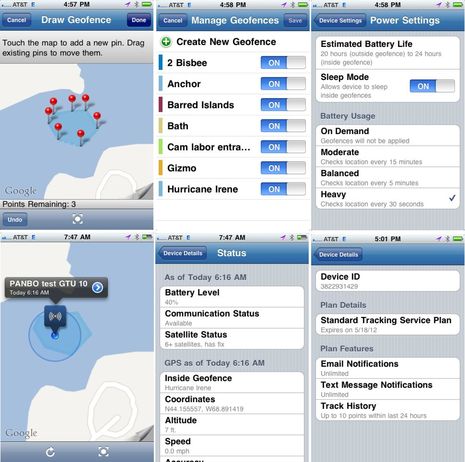
I was still able to create a working anchor watch geofence during the recent weather scare, as you can see in the screens below. In fact, I use a number of geofences as shown in the second screen. The third shows that you can set up different power usage settings, which make a big difference on battery life. And the fourth shows how your phone's actual position does show up on the regular map view. If the phone and GTU are miles apart -- as might be the case if someone ran off with your dinghy -- the app will even set up go-to navigation to the GTU.
The fifth screen shows some of the detailed info you get when you "locate" the GTU, though it must be said that getting the GTU to respond can sometimes take several minutes or longer. I'm not sure why that is, as the GTU can be very quick about geofence notifications (depending on settings), but it's certainly been noted in other reviews (like GPSTrackLog's, which also links to others)...


The GTU10 can also serve as a USB GPS source for a PC, though Garmin doesn't mention that feature anywhere I can find. In fact, I was surprised one day when I was charging the unit and a just-opened charting program used it to plot precise position. And today I discovered that the GTU can do amazingly detailed tracking if you purchase the extra $5 a month plan. If you could drill in on the MyGarmin screen below, you'd see my bike ride down to the store for an afternoon snack detailed by the minute and as is you can see yesterday's Gizmo return through the geofences referenced above. If I was into stalking myself, I'd love the GTU (seriously, that's the downside of these GPS trackers).
At any rate, while I think the GTU can be useful to boaters, I can't help but imagine what Garmin could do by mixing the resources they developed to support it with the GDL 40 cellular weather system they introduced last spring. I've been testing it too, and it continues to perform well as discussed in June. But, darn, that means I already have Garmin cell modem installed high on Gizmo and connected to, and powered by, its NMEA 2000 network. Wouldn't it be neat to communicate with the GDL via one of Garmin's apps? Come to think of it, wouldn't it be neat if Garmin put an anchor watch screen on its GMI 10 instruments and/or its MFDs, so I could monitor onboard or off? I really have no idea what Garmin is up to in this regard, but aren't the possibilities interesting?

 Share
Share
I do this at the moment with my iPad (thats left on the boat), and iPhone (thats in my pocket). With Apple's Find My Phone. Its all free with the system I already have.