Furuno GP-33 GPS, hand's on

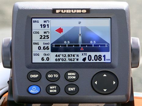
At the risk of sounding mean, what excites me most about Furuno's new GP-33 GPS sensor and display is what it means regarding the coming RD-33 data display we discussed a while back. That 4.3-inch 480x272 pixel LED-backlit screen -- seen above in bright sunlight on Gizmo's flying bridge -- is pleasingly crisp and bright. And note how legible and even handsome the screen designs are, and how Furuno has dropped some of the numerical over-precision that has drawn criticism from users of NavNet 3D MFDs and FI50 instruments. You get all that screen goodness -- 50% more area than a Garmin GMI 10, Furuno claims -- for a maximum of 7 LENS (350 milliamps) of 12v power off a NMEA 2000 backbone...
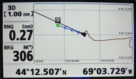
The GP-33 can also be powered independently, with 24v even, and there's an optional cable for NMEA 0183 and/or RS232 connections. In other words, it can be a standalone GPS, or part of a network. Used in the latter mode, I was hoping that activating a go-to waypoint on the NN3D MFD12, or another MFD, would bring up the same waypoint on the GP-33, so I could easily use its nice steering, rolling road, COG compass, and plotting screens. But that feature, while planned for a future software upgrade, is not yet enabled.At any rate, the GP-33 also seems quite quick and does come now with lots of GPS features, like an enormous track and waypoint capacity and the ability to convert LORAN TDs, even with offsets calculated in, if you saved them. It can also accept and plot an external MOB alert, or activate an external alarm based on several criteria like waypoint arrival or anchor dragging. And a user gets to customize two of the seven screens, though only GPS-related data fields are available. Any navigator who likes to have a separate GPS -- and I see them often, especially on fishing boats -- may be tickled by the GP-33, which seems reasonable at $595 MSRP. As noted, though, I'm keen to see how Furuno uses this fine screen for NMEA 2000 data display, purportedly with some neat graphics and 0183 bridging built in.


 Share
Share
Incidentally, I understand that uploading routes and waypoints from MaxSea to the GP-33 is easy, and I suspect it's possible with Coastal Explorer, which already supported the GP-32:
http://coastalexplorer.net/support/hardware/GPS/furuno_gp32?qx=164gh5e.1
But do other progams support Furuno route and waypoint data formats?