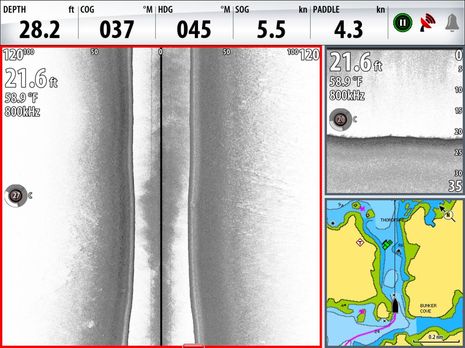
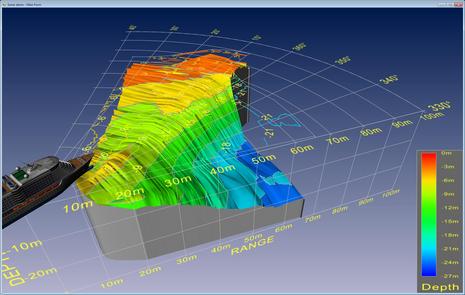
Rats! I thought I'd recount some of the summer's Simrad StructureScan experience since I mentioned it in Monday's entry about chart problems, and while I was pleased to find a screenshot taken right in the Thorofare discussed...I failed to snap one after passing over the disputed danger. But you can see how flat and smooth the bottom is just short of what is supposed to an "awash (at low tide) rock"; please trust that the bottom stayed just like that as I drove right over the annoyance, as I posted on AC. But maybe you can't intrepret the screen above well until you see more of what this side looking technology can do...
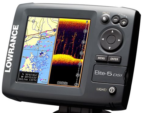
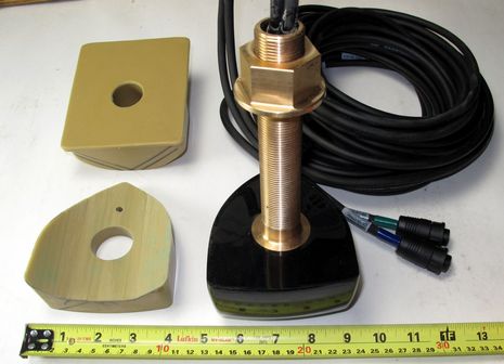
Last week Lowrance announced the Elite-5 DSI and some related fishfinder/plotters, and while they're unabashedly aimed at freshwater fishermen, there's at least two things of interest to others. DSI stands for DownScan Imaging, which seems to mean that Lowrance has isolated the high resolution down-looking portion of StructureScan into an even more inexpensive form. That means a transducer that can ping at 455 or 800 kHz, trading detail for depth and breadth. Aren't lots of non-fishing boaters -- like gunkholers and/or curious monkeys like me -- also interested in detailed bottom imagery, even if it's only to 100 feet or so? That's why I installed StructureScan on Gizmo even though the thru-hull transducer wasn't ready yet, and I can't wait to seriously experiment with it (soon!). The new Lowrance plotters will also be the first I know of to exclusively use MicroSD chart cards...
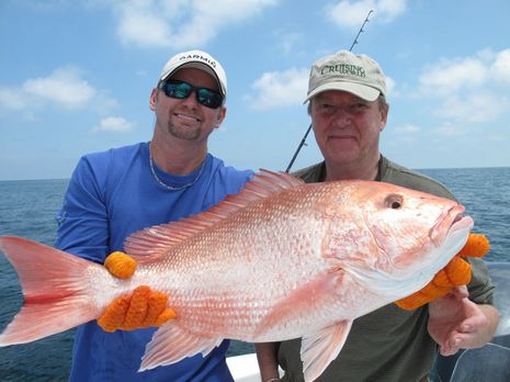
Phase two of the Garmin extravaganza -- a fishing trip off Texas with pro angler Bill Platt -- may not have gone quite as planned, but I don't think you need much more than this image of calm seas, blue sky, and a huge ass red snapper to know that it was truly a blast...
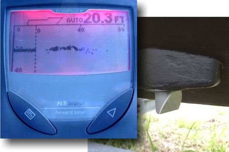
That's a beautifully built Interphase forward looking sonar (FLS) transducer -- actually two phased array transducers, one 90� vertical and one 90� horizontal, cast into the same epoxy block (hence the dual outputs). It can be used with several Interphase FLS models, but I'm looking forward to trying it with the company's new Ultrascan PC90, discussed here last Fall. And I went to some trouble, including carefully band sawing that fairing block, to give it a good view. In fact, some may call me crazy...
The concept is pretty sensational: The ARGUS (Autonomous Remote Global Underwater Surveillance) system would equip volunteer vessels with a custom WiFi transceiver that is connected to the nav system for GPS and depth, and that can automatically upload the resulting data files (when possible) to a shore server where it's collated and quality controlled before being turned over to NOAA so it can better manage its dredging and charting responsibilities. If it all works out as hoped, the volunteers might even get the equipment for free and be able to use the WiFi connection for their own Internet needs...
In
general the feeling was quietly positive. Everyone still around will probably be able to weather the remainder of the economic storm. Attendance today was lower than the earlier two editions I visited, but then this was my first time visiting on the last day so I can't say for
sure how busy it was. Sorry to say, there was no big big news. Still there were a number of exciting new developments. I've kept those to the end of this long mail!
Even though the EchoPilot Foward Looking Sonar (FLS) I tried back in 2002 couldn't see very far and wasn't reliable (kelp seemed able to hide even steep Maine ledges), it hooked me on the potential of the technology. In tricky waters my eye regularly flicked to that little screen above, hoping to see the bottom ahead. Thus I got excited when Furuno previewed a purportedly powerful FLS in 2005, and again when hints arose last winter. But that product has never surfaced. Forward scanning obsessed Interphase, however, is attacking FLS issues from two directions...
On Monday I spent a few hours cruising around the Harbor and Bay with Lowrance's StructureScan module attached to an HDS-10. Impressive! This upstart seemed to image the bottom as well as the Humminbird 1197C I was also running, and Humminbird has completely owned this niche for years. Lowrance's side imaging also seems easier to use. Humminbird SI, for instance, doesn't have an auto range feature that adjusts the displayed bottom width (and resolution) according to the depth, nor does it have the useful soft keys seen above. They both work pretty well, though, and the more I use them, the more I think they're valuable to fisherman and even cruisers...
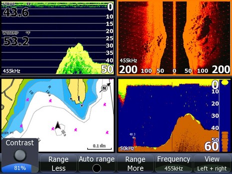
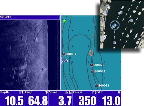
The cropped Google Earth iPhone image upper right shows Gizmo's location (Google Maps version here) among the strings of mooring floats in Camden's inner harbor, strings I ran up and down with the Humminbird 1197C now installed on Li'l Gizmo. Over and over again, because I couldn't believe the detail I was seeing with side imaging! There are thousands of Camden Harbor images on the web (including on Panbo), but I don't think anyone, divers included, has seen the bottom as well as in that bluish half screen above. Ever wonder how all those 30' x 6' two-boat floats stay safe and orderly in 10 feet of water plus 10-12 feet of tide? Well, that's my float's up-harbor 2 ton granite mooring at the screen top left, just west of my northern neighbor's down-harbor block. You can see not only the heavy bottom chain, and the furrows it's been digging when tide and wind shift Gizmo around, but even -- once your eye is trained -- the 6"x6" skid under the float itself (that straight white line lower left). And this image was no fluke!