Flash: C-Map and Navico become sister companies

... written for Panbo by Ben Ellison and posted on Mar 16, 2016

Boeing_sells_C-Map_to_Altor_(Navico)_aPanbo.jpgHere's some big news in the small world of marine electronics. Boeing company Jeppesen just sold its marine cartography division to a formerly unknown entity named Digital Marine Solutions (DMS) and it "will trade under the C-Map brand name" (as it did before Jeppesen came along and as many of us could never stop calling it). DMS belongs to the "Nordic-based Altor family of private equity funds" which also owns the Navico family of Lowrance, B&G, Simrad, and GoFree brands. Interesting?

I should not be awake at 2am -- a caffeine related miscalculation -- but what a lark to receive the Digital Marine Solutions press release and the Jeppesen press release almost simultaneously.

----- zzzzz ----- zzzzz ----- zzzzz ----- zzzzz ----- zzzzz ----- zzzzz -----

Let's discuss what C-Map's new business status may mean. Here are some first impressions in the light of day:

  • Positioning C-Map as an independent brand under the wing of DMS seems to make obvious sense, and I suspect that C-Map will remain the name we use for its vast portfolio of charts and related data products. After a period of apparent dormancy under Jeppesen, C-Map by Jeppesen has come a long way in recent years and at least some level of C-Map cartography is now supported on systems by Raymarine, Furuno, Humminbird, and others, as well as the three Navico plotter brands. Will Altor keep C-Map independent something like the way Garmin has let Fusion Entertainment?

  • It's good that the days when the major MFD brands worried about being dependent on a single chart supplier -- and we also struggled with that limitation -- are pretty much over. But having multiple development teams at work on the expanding integration of charting and electronics does not always go smoothly. I suspect that a lot of MFD manufacturers envy the Garmin do-it-all model, and I know that some boaters swear by it. So then, doesn't putting C-Map and Navico under one Altor roof bode well for smooth and fast developing Lowrance, B&G, and Simrad charting, at least after the transition period?

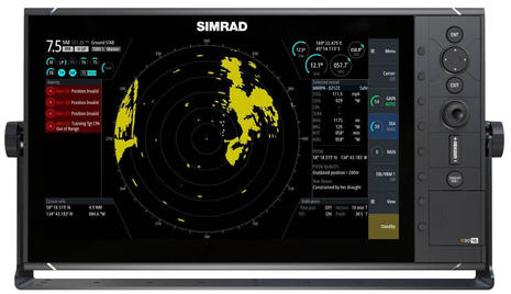
  • It strikes me as possible that Altor's main motivation is to enhance Simrad Professional. While C-Map is working hard to go head-to-head with Navionics and Garmin cartography in recreational marine, I gather that Jeppesen/C-Map commercial is a fairly dominant product line. And incidentally, an interesting realization in Miami was that Simrad Pro's new standalone radars and sonars are based the Navico Operating System (NOS), which greases the way for feature migration up and down the Navico brands. Furuno already mixes recreational and commercial to some degree, but will the C-Map move help Simrad Pro toward its stated goal, a piece of Furuno's commercial market?

Simrad_Professional_R3016_aPanbo.jpg

Comments

I have had a friend working on Jeppson's marine product line for a while now which I always thought was strange, especially after Boeing acquired them. I'm not surprised.

Posted by: R at March 16, 2016 2:50 AM | Reply

Maybe I go overboard with the business side of marine electronics, but I find it fascinating and also think it's valuable for consumers to have some idea about what's going on. For many deciding on a primary electronics system has become a bit like getting married! Fortunately all the major choices are looking quite attractive these days, but where it's all going in the long run I have no idea.

Posted by: Ben E at March 16, 2016 10:15 AM | Reply

Ben,

I might be a bit biased myself :) but I believe understanding things like this are critical for consumers not just when purchasing a new system, but on a yearly basis when doing maintenance, chart upgrades, and the like.

Consolidation is always a concern when it limits your choices, but it can be good too - having a smaller company get an infusion of cash and new people/ideas as an example. I hope that C-Map stays independent enough so that their charts could be used on other devices.

It is definitely like getting married when you choose a particular brand! Getting a divorce is also sometimes as costly! Regardless of N2K, SignalK, or any other devices that help with interoperability, there's nothing like having a single vendor for the key pieces of electronics on the boat. Sure, there are still problems with interop even within a brand, but they pale in comparison to what I've seen with my multitudes of testing.

I hope that this change gives Navionics a better competitor - I really like the C-Map offering, and would like to see it continue to improve.

Posted by: Steve Mitchell at March 16, 2016 3:37 PM | Reply

Ben, stay aboard, as news like this is very interesting and might give you a chance to predict pieces of the future of marine electronics, or rule out less probable parts of it. Thank you and don't shy future flashes!

Posted by: Kim in reply to Ben E at March 16, 2016 4:16 PM | Reply

Thanks, Steve. I really doubt that the new C-Map will try to limit its sales channels. Heck, the long strategy could be quite the opposite. One thing I learned early on is that Garmin is the most feared competitor, and that started when Garmin was hardly present in marine electronics. I guess Garmin's size, resources, and business models can look pretty scary from some desks.

Add to that the recent intellectual property fights between Garmin and Navico. Most people I know in the industry -- product managers, engineers, and marketing folks mostly -- are reasonably friendly with eachother, but this patent stuff has gotten a little hot.

At any rate, maybe under Altor C-Map will continue to do what it's doing, but hopefully even better. So C-Map works closely with all the vendors that support multiple chart types (maybe Navico especially) and maybe Altor makes a little money while also diminishing one of Garmin's strengths (in house cartography). And, by the way, Garmin only supporting Garmin charts with no raster option has begun to seem a little limited.

On the other hand, Raymarine, Furuno or others bridle at helping to put some money in Altor/Navico's hands. And maybe there's an opportunity here for Navionics to forge an even tighter relationship with, say, Raymarine. We shall see.

PS Maybe we should meet at a show sometime and try doing a half serious video, sportscaster half-time game analysis style. METS would be good as the classy press room looks out over hundreds of trade booths and we might be able to get a coach (CEO) or two to weigh in ;-)

Posted by: Ben E in reply to Steve Mitchell at March 16, 2016 7:09 PM | Reply

Curiouser and Curiouser. One would hope that the conglomerations would enable higher functionality and more resources to be deployed. Having way too much "fun" with Navico, trying to make sense of MFD vs sonar features vs sub-brands at the moment to fully appreciate the potential joy.

Posted by: Sheldon Haynie at March 17, 2016 1:37 PM | Reply

All good points, Ben. I think it will be very interesting to see if Garmin starts producing more chart options or overlays to deal with the raster situation. I love that they do their own thing, but I sure prefer Navionics or C-Map for all of the different representations. Perhaps this change will drive them, as you mention.

Shake ups are always a good thing to see what happens with the market, so I'm hoping it's all stuff that benefits the consumer, like me!

I would love to setup some video cameras at a show and even have a presidential-style debate between the big map guys :) Or just the MFD manufacturers. That might be hoping for too much...

Posted by: Steve Mitchell in reply to Ben E at March 18, 2016 3:48 AM | Reply

CMAP were on the brink of going under. Actor did a good job of turning the Navico brands around and making them profitable when they were in a similar position. Hopefully this will ensure that there continues to be a good competitive market for cartography.

Posted by: Tom at March 19, 2016 6:13 AM | Reply

Interesting! Johnson Outdoors (Humminbird) has just acquired Northport Systems (Fugawi), which provides many charting services to Navico and Raymarine, among others:

http://investor.johnsonoutdoors.com/releasedetail.cfm?ReleaseID=963649

https://www.panbo.com/archives/2015/03/raymarine_chart_store_the_lighthouse_format_go_international.html

Posted by: Ben E at April 6, 2016 10:53 AM | Reply

Ben,
I fell into a hole with Simrad - GoFree and C-MAP that has me wondering if either side knows what they are doing.
I have Simrad equipment and downloaded my 2015 charts from the Simrad GoFree web site. When you download them, you copy the files onto an SD card and put them in your plotter.
Now that it is 2016, and wanting the Active Captain data, I have been trying to update my charts. C-Map Club does not honor that you have already bought charts if they are not on their branded SD cards. Simrad's GoFree site does not offer a way to update the charts other than purchase all new charts.
I considered the Navionics Update promo but they require the C-Map branded SD card also.
Lesson learned - do not use Simrad's GoFree site for ordering charts.
I have looked at the Insight Planner software to allow me to plan my routes on my laptop but one page of the site shows it supports C-Map and another page does not show C-Map. I have asked if the C-Map charts I own for the chartplotter can be used with Insight Planner or if I need to purchase a duplicate set in the Insight Planner format, and I have not gotten an answer to that.
I have the same sets of charts for my Coastal Explorer but they too are in a different format usable only for CE.
When you by a music CD, it can be played on your stereo, car radio, computer, iPad, etc...why can't charts have a standard format (except probably Garmin)?

Posted by: HenryD at April 18, 2016 5:33 PM | Reply

HenryD,

I wish that charts were more agnostic as well and that you could use them in whatever MFD or software you wanted. Unfortunately as you even pointed out, Garmin will likely always be Garmin-only because they make their own, and as things consolidate as covered in the original post here, I don't think it's going to make it any better.

I do like manufacturers like Raymarine who for a small fee are re-packaging the Raster and Vector NOAA charts. Lighthouse Charts are only about $9 and are essentially what you have on Coastal Explorer, which I also use. I'm OK with paying that small amount since they have to repackage them for the Ray MFD.

Where I start to get irritated is paying $200-400 a year to update charts on an MFD, and then similarly on my PC. Their update process, at least for Navionics and C-MAP, are terribly out of date and take gigabytes of data, something most of us do not have directly on the boat.

Still work left to do....

Posted by: Steve Mitchell in reply to HenryD at April 19, 2016 12:15 PM | Reply

Yes, Navico's sale was announced last Tuesday, but it's hard to imagine a less newsworthy transaction. The entire company -- plus the semi-separate Digital Marine Solutions that acquired Jeppesen Marine last March -- are moving from one Altor fund to another Altor fund which is partnered with Goldman Sachs Merchant Banking Division.

http://navico.com/navico-get-new-owners-support-growth/

It's hard to see how this changes anything for Navico, but maybe someone sees more to it?

Meanwhile, Jeppesen C-Map has fully returned to the C-Map brand name for both commercial and light marine, and it's certainly looking independent:

http://www.c-map.com/

Posted by: Ben E at July 16, 2016 8:56 AM | Reply

Ben,
Its basically taking the going concern from the 2003 fund;s books and selling it internally to new money in the "Altor IV" with participation from GS, freeing up cash in the Altor 2003 fund and that the quotes in the PR are Altor: " The high performing recreational business is an asset that also can be leveraged to grow in the commercial segment over the coming years. The digital platform represents a unique platform to participate in – and drive the digitalization of commercial marine in partnership with other industry players, with additional strength being brought to the platform by the new owners’ acquisition of Digital Marine Solutions from the Altor 2003 Fund”

and from the GS side: "We are impressed with Navico’s track record and speed of innovation”, says Michael Specht Bruun, Managing Director in the Merchant Banking Division of Goldman Sachs. “Through our partnership with Altor Fund IV we look forward to supporting the company and accelerating its organic and acquisition based growth”.

So this would suggest GS is seeking return by putting money in and turning the crank faster. So look for both the Simrad Commercial line to be pushed perhaps in competition with Furuno for smaller commercial vessels and also to drive the market with additional R&SD Spending,

Posted by: Sheldon Haynie at July 18, 2016 1:30 PM | Reply

Interesting! Hopes for a C-Map that works with many MFD developers even while sister to Navico seem vindicated in this press release, which also suggests that Navico will add value to C-Maps:

"C-MAP has announced new U.S. mapping products — C-MAP Insight Pro and C-MAP Lake Insight HD. Combining the trusted chart detail, unique content and popular graphical presentation of C-MAP cartography with exclusive chart data from GoFree® Lake Insight charts C-MAP creates all new mapping options for boaters. These new charting packages will be offered as both an option and embedded cartography for Lowrance®, Simrad® and B&G® displays starting in 2017 and, as a result of the further development of the Insight offering to a broader audience of boaters and fishermen, Raymarine and Furuno customers will be able to access Insight products when made available in upcoming C-MAP 4D releases."

Posted by: Ben E at November 2, 2016 3:28 PM | Reply

Interesting! Last week C-Map acquired i-Sea, a Norwegian charting company...

https://plus.ibinews.com/article/vvsjoZjipDE/2017/09/21/c-map_acquires_i-sea/

...and while I was not familiar with i-Sea, I now realize that they have already developed a notably modern vector charting app for PC, iOS, and Android. Free versions of Embark include good charts of the U.S., easy routing that syncs across all platforms and well designed crowdsourcing.

https://letsembark.io

Posted by: Ben E at September 28, 2017 10:26 AM | Reply

Leave a comment