USHarbors, a new crowd source player?
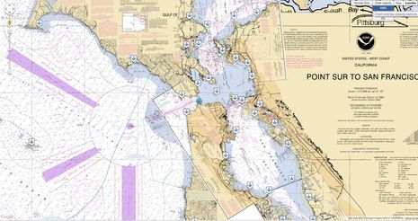
The Maine Boatbuilders Show starts today, and I'm making my (almost) annual pilgrimage to Portland first thing this morning. But I've already spent some quality time trying out a show debut, the rather spectacular update of the USHarbors Network. Among many major enhancements is a full screen raster-charts-over-Google-Maps mode that may well be the best online charting engine I've ever seen. Note how it's even quilting in skewed small craft charts at the particular zoom level I captured above. That's hard, and moving around on these charts is fast!...
But be aware that you can't do much on these charts, unlike, say, ActiveCaptain where you can create specific points of interest and even share routes (as discussed in November). USHarbors is a different animal, and as its name implies it's harbor centric. Sure, you can wander the whole mainland US coast clicking on various POI icons, but when you want to dig into its deep info resources or add to them, you do it by harbor (1,100 of them so far).
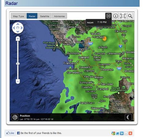
For instance, I was on the San Francisco page when I clicked on weather and found a well laid page of it culminating in the very nice radar map below. It too is Google Map based and it too can go full screen and let you wander around. It animates more than an hour of NEXRAD data with intensity coloration that works well for me, and I can zoom out to half the country without it hiccuping. (I have broadband here, but not especially fast broadband.)
USHarbors actually started with tide tables, good looking ones that print well too, but now the monthly predictions extend out a year. You may also notice a distinctly Maine bias in the ads below and that's because this whole project is a branch of Maine Boats, Homes & Harbors, the magazine I've written for the longest. In fact, I know the creators of this site well and if I'm at all over enthusiastic about it, it may be because I have some sense of how long and hard they've worked...
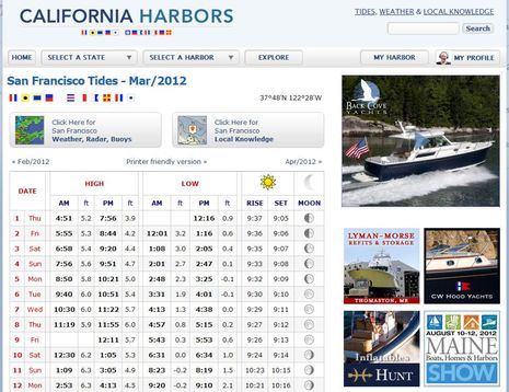
Of course the business plan is to sell ads to local marine businesses in California as well as Maine, but that will take some time. I noted, though, that any business can be listed on the site and can also post blog-style entries, photo galleries, and the other types of content regular boaters can. Seems smart to me.
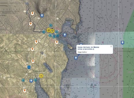
The cropped full screen chart below shows how many different data and crowd sourced POIs there can be in an area where folks have gotten into it. You can also see the icon circles that appear as you zoom out so that individual ones don't pile on top of each other...
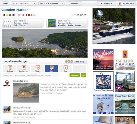
Lastly here's a look at what the main harbor screen looks like, in this case My Harbor. This is the hub from which you can click to local weather, tides, and charting. And in the Local Knowledge section you can switch between lists of long post Updates, Businesses, Photos, Tips, and pilot book style Info. They all seem polished -- either viewing or adding -- but Tips is the new one, and I suspect it will be a hit. It's funny how 140 characters and one photo is the sort of limit that makes sharing easier.
All in all, USHarbors has a lot going for it even if the people around your harbor, or the ones you'd like to visit, don't get into it. If they do, sky's the limit! Of course it's a wicked challenge to make so much information and sharing easy to navigate, but I'd say USHarbors is easier than FaceBook. Have I persuaded you to give USHarbors a good try? What do you think?

 Share
Share
It's worth adding that Navionics had news about its user generated content (UGC) features in Miami. Besides becoming the first crowd sourced data to get onto chart plotters -- the Raymarine e- and cSeries -- it can now include user collected depth soundings. More to come on that, but isn't it interesting how different all the marine crowd sourcing schemes are? Who will want access to all of them, and how will we get it?