Android marine apps: Memory-Map is in, who else?

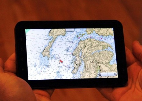
It's still in public Beta, but Memory-Map has an Android version of its charting app. I've tested it with both my Verizon Incredible phone and also with the 7-inch Galaxy Tab seen above, thanks to a loan from Memory-Map developer Richard Stephens, who I profiled way back in 2005. Even then Stephens was writing good PC and PDA charting software, and the experience shows...
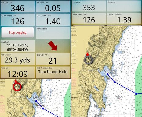
At this point there are a lot of good charting apps that display NOAA raster charts, but I don't think any show them quite as quite as well or zoom/pan them quite as quickly as Memory-Map. In this Android edition, Stephens has also come up with a nifty way of managing data windows. As I tried to illustrate in the two screens below, the windows work like a shade that you can roll up and down with your finger tip. So you just select the data in order of importance and adjust the shade as needed...

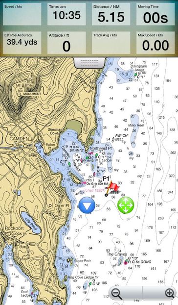
Frankly, though, ever since I bought an iPad it's been my preferred mobile charting device. So I was very curious to try my first Android tablet, and I'll concur with Stephens that the Samsung Galaxy Tab 7-incher is a nice size, big enough to navigate on but small enough to wear around your neck in a waterproof case (like he does when racing, I suspect). Just click on the screens above and below to see the pixel count difference. But I did not cozy up to its extra wide aspect ratio. Maybe it's just that I'm used to the iPad's 4:3 ratio or maybe it has something to do with the Golden Ratio that mad Installer Ranted so delightfully about this weekend...

The screen above also shows the neat way Memory-Map handles waypoints in all its app editions (Android, iOS and Win Mobile 7 coming). The cursor button lets you move the point while still seeing exactly where it's going to land while the arrow button leads you to a full menu of functions, like Edit, GoTo, Activate Route, etc. Nice! NOAA charting on Memory-Map is also free; you pay to get integration with the able PC version and/or to buy other charts, certain topo maps, or guide books.
Navionics, EarthNC, and Nutiteq are also doing good charting work on Android. In fact, I'm having a hard time keeping up with all the boating apps, and that's partly why I'm writing this entry. Panbo has soft launched a new Panbo Classifieds section and one of its goals is to showcase the work of marine app developers. I hope to generate a little extra Panbo income from it eventually but right now long-term ads are completely free and I hope developers will flock there. (Basic ads for manufacturers, installers, etc. -- and for used marine electronics, too -- are also free so, please, everyone get involved!)
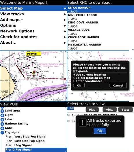
Incidentally, I think Android tablets will get some traction this year; I also recently tried a Toshiba Thrive 10.1-inch and liked it lot. But this app thing is going everywhere. Below, for instance, is a screen collage from what may be the first Blackberry marine charting app, GPS Nautical Charts. It too, like anything related to marine electronics, is welcome on Panbo Classifieds.


 Share
Share
You could add MXMariner to the Android list. It's pretty new - very inexpensive - and out now. As documented on their site, we're working with them on ActiveCaptain integration for a future release.
What's very interesting about MXMariner is the open source nature of the code behind it. From my understanding, there's a lot of open planning with the display engine code. That could easily spark a lot of other developers adding overlays and other functionality on top of charts. The code to create the charts is already open allowing anyone to convert chart data to MXMariner's format (even on the fly possibly).