
Coastal Explorer & ActiveCaptain, YES!
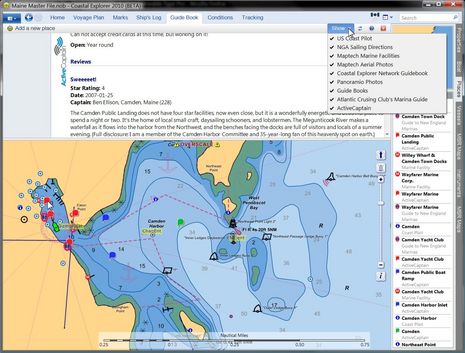
Take a good long gander at the full size screen above. That's Coastal Explorer 2010 in Guide Book mode, which already offered a wealth of port information, but as of last night (announcement here) can also show ActiveCaptain community generated info. The particular detail shown is my own enthusiastic take on our Public Landing, written when AC first launched (and still true), but notice how you can also access Atlantic Cruising Club's professional view of the facility, as well as three different angles on Wayfarer Marine and the Camden Yacht Club. The chances are good that a visiting boat can find all the information it needs in this one spot. In fact, while my entry on the neat ACC integration was titled "CE & ACC, great but not enough! Part 1," today Part 2 is pretty much irrelevant...
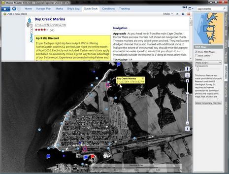
Meanwhile synchronization from Rose Point and ActiveCaptain servers to CE is working slick. When I looked around Cape Charles, VA -- which I used for that ACC entry -- there was one AC's new, and timely, CO-OP offers (which you can also see in action on the AC iPad mock up). CE also automatically downloaded the latest Camden chart to my PC, which turned out to be surprising, and a motivation to create an AC Hazard marker...
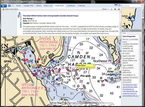
 As you can tell from the Properties box lower right on the screen below, NOAA just updated this chart last week, and yet CE has it on my machine already, gratis. But, geez, why did NOAA decide to add the town's channel buoys as if they were numbered nuns and cans when in fact they are just plain red and green balls? They are also set in straight lines along the channel that's clearly defined by the magenta Special Anchorage areas, except (check top image) NOAA's ENC for Camden has the north Anchorage line messed up. These mistakes are not exactly dangerous, but are a good example of why it's great to be able to share information easily and widely. The explanatory mark I created is already live at Active Captain, and it should sync onto CE any moment now. How cool is that!
There are many more new CE and AC features to discuss, but whereas I'm blowing my own horn this week, I'm proud to point out that I was quick to spot the developers involved as special talents, profiling Brad Christian in 2004 and Jeff Siegel in one of my first Panbo entries and in Voyaging. Both have been doing exceptional work recently, and watching them work together promises to be a real pleasure.
Hi Ben,
Yes that was added yesterday and it's presentation is great. No problems with installing the add on as well. There are other great new things in the works as well on the 2010 Beta including Navtex and just loads of other stuff.
I'm proud to be a member of the beta test team for what is going to be a Stunning Nav Program.
Steve.