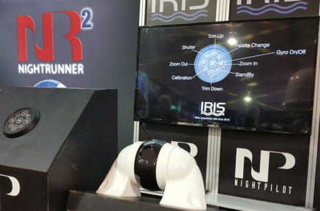
Stormtroopers will be pleased with a new value-priced gyro stabilized thermal camera from Iris Corporation. The Iris255 NightPilot looks like an accessory from Star Wars and includes some pretty hi-tech wizardry considering its $4,895 suggested retail price. Specs include 320 x 240 resolution, 8x digital zoom, and built-in heater with automatic temperature control for cold conditions. And since Panbo wondered if the Iris NightRunner PTZ cam "was too good to be true" in 2013, the company seems to have established itself as a serious player in lower priced thermal cameras...
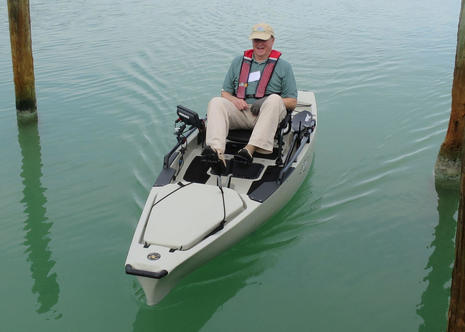
After four marine events (and three round trips to Florida) in five weeks, I've toured or ridden a lot of nice boats or at least interestingly equipped ones. But some solo time on a Hobie Mirage Pro Angler 14 during the Navico writer's event at Hawk's Cay easily stands out. I think the design is only filed in Hobie's kayak section because "fishing kayaks" have evolved so fast a better category name hasn't emerged yet, and that thought doesn't include the unusual Mirage pedal-to-fin propulsion. Whatever you call it, this is a cool boat, and not just for fishing (though it must be a blast to play a big one from that low throne)...
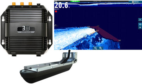
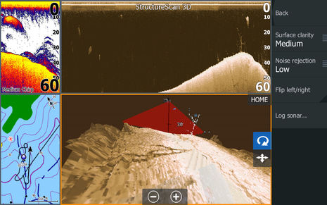
When I wrote about the StructureScan 3D announcement last July, I recall feeling a dite skeptical. Sure, the screenshots suggested that new users could more easily understand the 3D presentation of the sidescan data, but I wondered if they wouldn't go back to the apparently more detailed 2D presentation once they got a handle on it. But I was wrong. On-water demos have taught me that SS3D is much more than a visual gimmick. The 3D view can be really useful, especially for fishing, even though the new 3D transducer also produces the best 2D StructureScan imagery yet, plus there's some interesting and potentially valuable science going on behind the screens...
Garmin put up a Marine 2016 site this morning and one thing many current Garmin owners will be excited about is the Quickdraw Contours sonar charting that will come to many current Garmin displays in January. Yup, you're going to be able to easily collect soundings as you cruise, sail or fish and, if you want, you can watch the resulting high def sonar chart materialize in your wake, as suggested above. Quickdraw is no surprise given the tussle over Navionics SonarCharts for Garmin, but naturally Garmin added some special sauce...
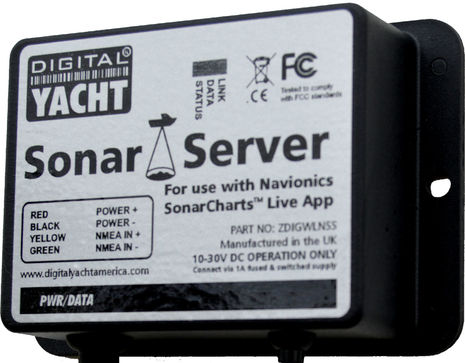
I'm really impressed with the Digital Yacht Sonar Server introduced last week, though it has almost nothing to do with the technology involved. In fact, I think the DY developers could have engineered this product in their sleep, as could several other companies that specialize in NMEA 0183 utility hardware. What's brilliant here is a simple, reasonably priced, and fast-to-market solution for certain boaters who are understandably hot to use the Navionics SonarCharts Live app feature on their phone or tablet. And Digital Yacht has backed up their marketing smarts with deep info on how to install the Sonar Server...
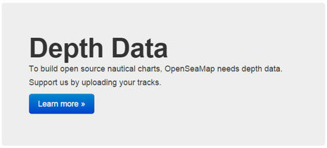
I've been cogitating a lot about crowdsourced depth data lately, including the realization that "community sourced" is a better term. Whatever it's called, Navionics in particular has made it wonderfully easy to collect and share sonar files and especially wow with the Vexilar integration. But the business stakes are high and thus we have the frustration of Navionics and Garmin butting heads. Upon further contemplation, a wistful thought from that last entry -- "Wouldn't it be great if we could upload our data to some service that would make it available to any chart developer?" -- seems not only important to avoiding further messes and helping this technology proliferate, but also quite possible...
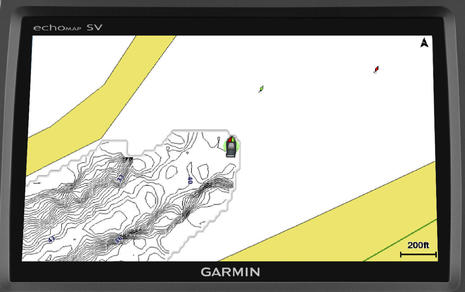
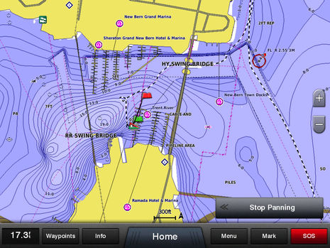
This screenshot shows the Garmin GPSMap 8212 installed on Gizmo displaying the same crowdsourced Navionics SonarChart bathymetric data that I recently enjoyed improving via the Navionics Boating app and Vexilar dinghy sonar. In fact, all the chart data seen above came from Navionics, even the beta version was fairly usable for navigation (I thought), and the finished chart cards are now for sale. But I doubt that many will be purchased once potential users realize how Garmin is reacting to this development! Navionics and Garmin seem nearly at war, and this entry will attempt to untangle what's happening. I fear there are no heroes in this battle, and it may even foreshadow further tensions in the critical world of chart and plotter manufacturers...
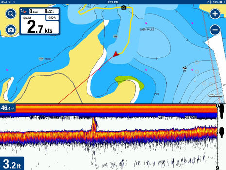
This mid-January screenshot represents a very pleasing experience in marine electronics testing. Thanks to a Vexilar SonarPhone T-Box SP200 and the Navionics Boating app I'm cruising around in my 9-foot dinghy with more than just charting and a fishfinder. I have access to three different chart formats plus a live SonarChart being created as I move along, and the data I'm collecting will be available to my fellow cruisers a week or two later. It sounds exotic, but the total cost was about $250 (iPad mini excepted), installation was fairly trivial, and it all worked quite well right out of the box.
Sorry for the blown out screens, but the point of this photo is Furuno USA marketing manager Dean Kurutz, who co-delivered the NavNet TZtouch2 introduction with senior product manager Eric Kunz just like they did with the original NavNet in 2001 -- when I was just getting into electronics writing -- and every NavNet update since. The dynamic duo have been coming to Miami with the company since well into the last century and a lot of their colleagues have similar histories. If you go Furuno you get remarkable management consistency and institutional memory, but that doesn't mean they're old school...

 Stormtroopers will be pleased with a new value-priced gyro stabilized thermal camera from Iris Corporation. The Iris255 NightPilot looks like an accessory from Star Wars and includes some pretty hi-tech wizardry considering its $4,895 suggested retail price. Specs include 320 x 240 resolution, 8x digital zoom, and built-in heater with automatic temperature control for cold conditions. And since Panbo wondered if the Iris NightRunner PTZ cam "was too good to be true" in 2013, the company seems to have established itself as a serious player in lower priced thermal cameras...