
Garmin GPSMap 640, hands-on #1
... written for Panbo by Ben Ellison and posted on Apr 20, 2009
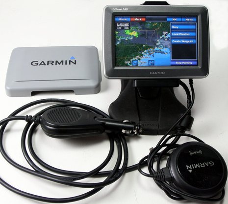
One gizmo that's definitely coming along on the Gizmo delivery is this Garmin 640 beta unit. In nüvi mode it can navigate the highways down to Connecticut, as it's done well twice already, and I can then reboot it into marine mode for the voyage home, with XM audio and weather available all the while. The marine satellite weather presentation seems particularly good, as you can see somewhat if you click on the screen above; it's set up so that the Nexrad radar and cloud cover are animated and a finger tap leads to a choice of local forecasts, buoy data, and more, depending where you tap. But finding a good place for this 18 ounce "portable" on your dash or at your helm may not be easy...
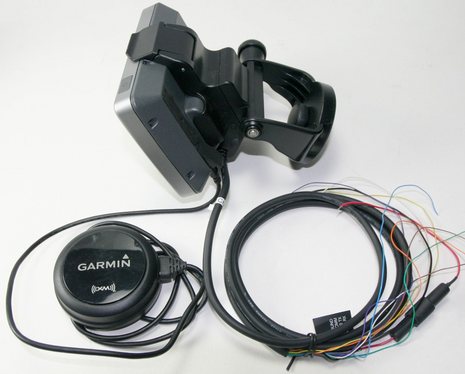
Note that the marine mount's power cable includes two NMEA 0183 ports (N2K would have been sweet, but these will work for AIS, wind, depth, etc.). It also has stereo output wires, and both bases accommodate stereo mini jacks. So you can use a 640 in many ways, including maximization of an XM subscription (now less expensive, but still not trivial). I do wish the 640 showed more weather detail in street nav mode, but then again know that Garmin has pleased many customers by keeping things simple. The marine nav mode looks good, except perhaps for its inability to do split windows, but I'll save that discussion until I've really used it on the water. I will note, though, that when Garmin says "modes" it's not kidding. The 640 (and probably its GPSMap 620 cousin) are truly dual boot devices. It's not a significant hassle, but the street and marine modes acquire GPS fixes separately, store weather data separately, and even get updated separately.
Ben,
Where from/ when is the delivery? Do you need company or a hand? Are you going to "document" the event?
As you may recall I have written about my Garmin PDA iQue which does marine and streets, but is rather basic compared to the 640. But mine fits in a shirt pocket, no sweat. The battery sucks. But up close, these little guys are great.