
Navionics Mobile, & other iPhone apps
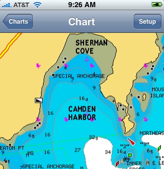
It’s come to my attention that not every Panbo reader is obsessed with AIS! So how about a new charting app for the iPhone? That would be Navionics Mobile, which was just introduced at the Genoa Boat Show. It is, in fact, a relative of iNavX, the first iPhone charting app (why reinvent good code?), though obviously different. iNavX can’t download a NOAA raster chart of Genoa, Italy, for instance, and no raster chart can offer a choice of nav aid presentation as illustrated in the split screen shots above and below...
With Navionics Mobile you’ll also be able to query chart objects—like, perhaps, the detailed characteristics of a nav aid—and “much more” according to a brochure I’ve seen. Oh, and navigate ski trails of “over 460 resorts in the alps,” a feature that will no doubt expand as Navionics gets into Discovery Charts. I don’t know what the app will cost when released, but you can see it at coming boat shows and/or sign up for notification of availability.
Meanwhile, a third iPhone nav app from Navimatics is already at the Apple app store, but since it’s based on NOAA ENC vector charts, I don’t think it offers complete U.S. coastal coverage yet. (Note that Navimatics also makes ENC-based Garmin charts that look good, but may also be incomplete until NOAA finishes the ENC portfolio.) Remember too that ActiveCaptain Mobile for the iPhone is “coming soon,” and it will be the one that can also use the phone to connect with a live cruising POI site. While traveling the last several days, I saw iPhones everywhere, plus visited a San Diego Apple store that was by far the most crowded in the mall; apparently even ship pilots are into the darn things.

I have started beta testing for iNavX so I can't say much here, but while I prefer raster charts to vector charts, the advantages of potential extended regions of coverage are quite exciting. As far as use by professionals go, I turned a friend of mine onto iNavX who is a Tug & barge first mate as well as yacht delivery captain. He ended up navigation almost an entire 30 hour delivery using the iphone because the boats gps crapped out early in the trip. He now swears by it as a backup he will always have with him.