
RNC disruption, not as bad as it sounds?
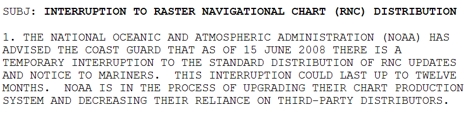
The U.S. Government has stopped distributing electronic updates to the official raster charts for up to 12 months? That doesn’t sound good. NOAA’s download site doesn’t mention a time frame for the “Interruption” but the U.S.C.G. internal bulletin shown in part above is more dire. (It’s published in full on Kurt Schwehr’s site, where you can also check out the Chart of the Future.) This is bad news for all of us who like using RNCs (Raster Navigation Charts) in the many charting programs that support them, not to mention Furuno, which decided to go with U.S. RNCs (and ENCs) in NavNet 3D and is already taking some heat for it. When NOAA decided to serve up RNCs free back in 2005, one of the big pluses was that they would be kept very current, and there were even little patch updates available. Besides, isn’t it depressing to any American that our government can’t even keep a relatively simple and inexpensive program like this going?
The situation seems even more depressing if you know that Maptech was that “third party” processing and distributing the RNCs under contract to NOAA. We already know the company is on the market, that the Captn Jack division apparently liquidated itself, and that Mapserver is off line. Add the company’s apparent failure to renew its NOAA contract on June 15, and you have to wonder if it’s simply folding all operations…i.e. no more charting software, printed ChartKits, guides, etc.? It was all these worries that got me in serious reporter mode yesterday. What I learned was reassuring:
- Maptech’s CEO says that in fact all the existing business lines are about to be sold to various parties, including one well known one (?). Products will continue to ship throughout the transition. And, while Maptech could not come to an agreement with NOAA about extending the RNC contract, the new owner of that division is in talks with NOAA now.
- A NOAA spokesman said that the possible 12 months of RNC interruption is a “very conservative” estimate, and I learned via an intermediary that NOAA is looking at three different RNC distribution options—the new Maptech owner presumably one of them—and hopes one will work out soon.
- Furuno is aware of all this and has a plan in place to have MapMedia scan updated NOAA paper charts if the RNC interruption goes on too long.
Sounds like we’ll get over this blip. I was also pleased to hear from NOAA that, “It is projected that we should have complete ENC coverage before 2010. With more funding and resources it's conceivable that complete ENC coverage would happen sooner.” And from Furuno that “MapMedia has also been able to improve the 'Quilting' of the NOAA ENC Data for NavNet 3D MFDs. This new quilting method will improve the presentation and appearance of the vector charts on all of the NavNet 3D MFDs, especially on the MFD8 and MFD12.”
This in from a well-informed reader:
Your post was interesting this morning. There are a few ancillary facts, though, that are germane to the issues you presented, particularly concerning the NOAA RNC website, ECS charts and ECDIS.
I don’t know if you’re aware, but the NOAA updates would not work unless a user had the uncorrected base charts that were included in Maptech’s old Professional Digital Chart kits. Recreational boaters almost never bought these, but these were a big seller to the US Coast Guard, who were a big user of Captain Voyager. So, for all practical purposes the updates on the NOAA website were useless because one needed to have the original uncorrected base charts loaded to apply the updates. Most users would have to download a complete new chart to obtain a corrected chart.
I don’t believe that NOAA will have all of the ENC’s completed by 2010. We’ve been promised a complete US library for some time and NOAA doesn’t have the money. They still have to “borrow” money from the FAA to print paper charts. The real problem with not having ENC’s for the entire U.S., or rest of the world for that matter, is the International Maritime Organization (IMO) based in London and the United Kingdom Hydrographic Office. The UKHO in particular insists that ENC’s be issued by an “Official Hydrographic Office”, mainly because the UKHO is trying to freeze C-Map Commercial, based in Norway, out of the picture. C-Map Commercial already has the entire world in S-57 format, and an efficient updating service. The UKHO’s rationale is that only an “Official Hydrographic Office” can control the quality of the ENC’s. This, of course, is pure bunk. The Federal Aviation Administration deems privately produced aviation charts as official and companies such as Jeppesen do a fine job. The UKHO is attempting to use their status as a government agency to dominate the commercial charting market, both for paper and electronic charting. What’s really mind boggling is the UKHO has entered into agreements with those countries that don’t have the technology to produce ENC’s.
I think you’ll find the following link interesting.
http://www.hydro-international.com/issues/articles/id394-Revival_of_ECDIS.html