
GPS to GE, best way?
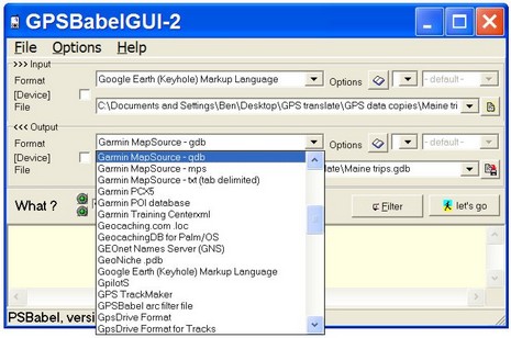
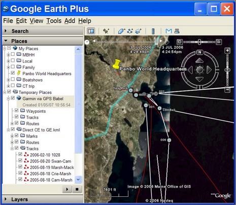
Panbo reader Ed is looking for a handheld GPS that will save tracks that he can overlay on Google Earth. I don’t know of any common handhelds that will produce .kml files directly (maybe you do?), but there sure are a lot of ways to make the conversion. Today I tried GPSBabel, which did a pretty good job of turning a Mapsource .gdb file full of waypoints, routes, and tracks into a file I could load into GE. Babel doesn’t know many of the more obscure marine GPS file formats, but it seems quite powerful and is freeware (donations encouraged). GPS Utility—also quite powerful (though $55 for a full version)—can import files from Furuno, Northstar, etc. Also, at least some charting programs, like Coastal Explorer, can import data from a Garmin and export it to Google. Any other ideas for Ed?
Another handy GPS converter is the GPS Visualizer (www.gpsvisualizer.com). It is a website that allows you to upload GPS tracks and it will produce Google Maps and Google Earth .kml files. The site also produces graphs of various data (speed, elevation, etc).