
Navman introduces NavPix, photographic waypoints
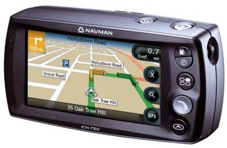
I don’t normally get into car navigation but this is an interesting idea, and it’s from a company that’s very much in Panbo’s radar. The Navman ICN750 above has a built-in camera meant not for snapshots but for easily shooting geopositioned photographs—dubbed NavPix—that you can later page through and select as go-to waypoints. Associated PC software and a NavPix Web site will even let you share such image waypoints with family, or the world. The press release quotes Navman USA general manager Chris Jensen thusly, “We tend to remember images better than we remember addresses. We all know what the Washington Monument looks like, but do we know the actual address? Most of us have commented to a driver at least once in our lives, ‘I’ll know it when I see it!’ Navman, NavPix technology and the global NavPix community set the new standard for navigation simplicity.”
Would this idea apply to marine plotters, where the ‘addresses’ are even harder to remember latitude/longitude numbers? Hell yes. In fact, I think boaters will eventually get all sorts of benefits from the fierce competition for the potentially humongous automobile navigation market. However, that same fierce competition is why it makes some sense for Brunswick to sell off the land navigation portion of Navman; it is not, as they say, a ‘core’ business. But why is Brunswick also selling off Navman’s marine division, already separated into Brunswick New Technologies Marine Electronics (BNTME) along with Northstar and MX Marine? I have heard a lot of rumors and speculation in the last week, but no one really seems to know. Tomorrow I get to chat with David Ritblatt, president of BNTME, and that should be interesting!
Very interesting idea. The challenging part would seem to be where to put the waypoint. Is it the thing you are seeing, or the point from which you take the photo? Or maybe just getting close is all that matters.