
Maptech buys ...#2, the plan
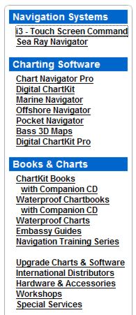 Yesterday we learned for sure that Maptech has acquired a bunch more marine navigation products, which must somehow be integrated with all the products it already sells. Heck, the long list at right doesn’t even include its latest offering. Here’s a peek at how it’s going to work as explained to me by Maptech PR manager Martin Fox and others:
* The Capn charting software—apparently the main impetus for this deal—will become Maptech’s commercial level product, with customization and fleet pricing available. Recreational users may be offered an easy switch to Chart Navigator Pro, and certainly won’t be left adrift. Dennis Mills, always the chief developer of The Capn, stays on as Product Manager (and is tickled about it).
* The SoftChart brand, on the other hand, will not survive, but some of its technology will. The plan is not finalized but Maptech may adopt some SoftChart features like its highly saturated raster chart color pallet (very effective on dim monitors) as well as a much less obvious “vertices” technique that improves chart quilting. Supposedly there’s also some interesting vector chart assets changing hands. Like Mills, Dick Davis—director of SoftChart cartography since 1995, and head of NOAA’s raster development team before that—is pleased about where his work has ended up, though he will not be working for Maptech.
* Maptech is “not sure” yet what it’s going to do with MarinePlanner.com, but I recall that the site has some interesting weather forecasting, trip planning, and other goodies (though they�re almost all locked behind a �membership� scheme right now).
* Finally, Captain Jack’s online and print catalogs will come back to life, but as an operation “totally separate” from Maptech. Fox must have used that “separate” word a dozen times, which got me laughing and is an indication that Maptech is a little nervous about annoying its own dealers. At any rate, the new Captain Jack’s “won’t look anything like a Maptech catalog” and its emphasis will be on “solutions”, i.e. bundles of products like, say, a GPS loaded with waypoints from an included ChartKit Book. I dare say it will also still include a nice collection of PC charting accessories, and that’s good.
I sure hope marineplanner.com survives. Still the best source for small quantities of international charts. If it were to be shut down many would lose their option to get up to 12 months worth of updates for a given purchased chart.