
Lowrance NauticPath, the rock problem
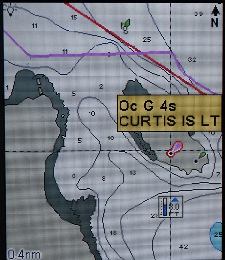
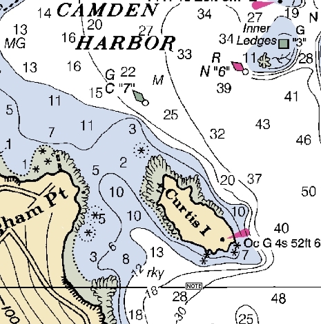
I’ve done more testing of the Lowrance ExplorerC handheld, and still like it a lot, but there are some real issues with the NauticPath charts. The main one is the absence of “obstructions that sometimes cover/uncover”, i.e. the damn rocks marked with asterisks on the paper chart below! Compare the two charts—soundings, bathy lines, high and low tide shore lines are all exactly the same…but rocks that may be just below the surface at any tide have vanished from the NauticPath (though I’m quite sure they were in the original Transas chart database). Those asterisk symbols are critical information, and they seem to be missing from NauticPath wherever I look around the country. The same is true on the LCX-111C downstairs, with a different copy of NauticPath on its hard drive, though on that machine the aids to navigation do not show double as they do on the Explorer (above). At any rate, I dare say the folks at Lowrance may be a little distracted right now, but I am going ask if they intend to put the rocks back in NauticPath.
Here is the NOAA ENC version..
Click Here