Computer charting this and that, #1

... written for Panbo by Ben Ellison and posted on Jan 5, 2006

GPSNavX_File_Menu

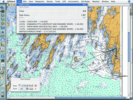
* Panbo reader Dan Hinckley has put together a thorough and useful review of his experience running both GPSNavX and MacENC on a Mac mini, which is where the screen shot above came from.

* A couple of readers have pointed out www.chartsdvd.com, which is the work of a sailing couple living in San Francisco. They’re offering all of NOAA’s free raster and vector charts on one DVD for $30, shipping included, nice and simple.

* At the other extreme of computer charting is WECDIS, the Warfare version of Electronic Chart Display and Information Systems. Slowly but surely the world’s navies are dumping paper charts in favor of WECDIS, or similar systems with different acronyms. The company supplying the British Royal Navy and hoping to get the U.S. business is OSI.

Comments

I would be very careful with what DVD one orders. If the source is NOAA's download site then you will end up with only 1016 charts, but if you go to Maptech's freeboatingcharts then you have access to 2077 charts. Before ordering any DVD make sure you contact the supplier to see exactly how many charts are included on the DVD and who the source of the charts is.

Posted by: GPSNavX at January 6, 2006 1:33 AM | Reply

Are you sure the difference isn't in the way insets are counted? Give us an example of a chart that is on freeboatingcharts and not on NOAA's site.

Anyway, a DVD is out of date very soon after you get it (if not before). The charts are updated with NTMs every two weeks, so why not download the fresh charts?

Posted by: Richard Stephens at January 6, 2006 1:46 AM | Reply

Will I am glad you asked. Without even looking hard I found freeboatcharts.com has 11379 (Mobile Bay, AL) where the NOAA RNC site did not.

11379 MOBILE BAY ALABAMA

Posted by: GPSNavX at January 6, 2006 5:42 AM | Reply

I just posted this note in response to a similar comment:

The coverage of the charts on the DVD ($30) I purchased matched the list offered on NOAA. I found that they reference them differently somehow on Maptech, making you think you are getting more charts when really it's the exact coverage. I'll keep reviewing, but for Mobile Alabama: on maptech that is shown as #11379, while on NOAA site it's 11380 for the same chart. Try searching maptech for 11380.

Posted by: Mark at January 6, 2006 7:05 AM | Reply

The entry by Dan Hinckley listed above has a dead link. Anyone know a live one?

Thanks.

Posted by: amkaplan at April 17, 2008 11:33 AM | Reply

The link has moved to:

http://hinckleys.net/dan/enav/ecnavx-new-1.html

The author claims that the info is outdated, probably because it is 3 years old and the programs have improved since then, but there is still some good information there.

Posted by: Chris Ellingsen at April 17, 2008 12:08 PM | Reply

Leave a comment