
Maptech + Rose Point = Chart Navigtor Pro!
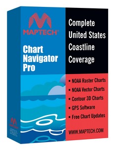 Whoa, things are happening even faster than enthusiastic yours truly thought possible. For $500, Maptech’s new Chart Navigator Pro (CNP) give’s you 13 (13!) DVDs containing NOAA’s entire portfolio of U.S. RNCs and ENCs, plus all of Maptech’s accessory cartography—photo maps, harbor panoramas, topos, bathy maps, pilot books, and information databases. But the real surprise inside is that Maptech ditched its aging, non-quilting, non-vector charting software in favor of Coastal Explorer. The name has changed, but CNP is CE 1.1 with nothing taken out and Maptech’s decent 3D contour engine added. CNP gets introduced today at the Fort Lauderdal Boat Show and will supposedly be in stores next month.
PS, 11/7: Thanks to Greg’s comment for a head’s up that Maptech has launched a new site, freeboatingcharts.com, where you can download all the U.S. RNCs you want. I don’t quite understand why Maptech is doing this before NOAA has a system in place, but it works fine. First you select the charts you want, then the site packages them up in a self executing zip file and notifies you when it’s ready for download. It only took maybe a half hour for me to receive the 15 charts that cover my area in all scales.
When will NOAA be releasing the RNC's to the public? Looking forward to pointing GPSNavX and MacENC customers to more free charts.