
MacENC, & how about those ENCs?
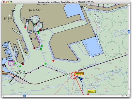
It was just last week that Rich Ray sent me this screenshot of MacENC, a new version of his GPSNavX charting program that supports NOAA’s free ENC vector charts. But after Tuesday’s news about free raster charts, it no longer seems like a big deal. Now we know that by about next spring Rich and other developers will probably be able to sell their charting software on a DVD that includes the digital equivalent of every single NOAA U.S. paper chart, without any encryption hassels and at little added cost. And users will be able to update those charts weekly if they want (making that easy will be another chance for developers to add value). But ENCs aren’t going away. They’re better than RNCs in many ways, and they’re definitely the future. Eventually—when ENCs are perfected and coverage complete—NOAA will drop raster chart production altogether, even printing paper charts from the vector database (if they print charts at all). Right now it’s quite useful to have both RNCs and ENCs for the same area; each has data or display features that the other lacks. In fact, if I was a Mac person, I wouldn’t think twice about paying the extra $35 for MacENC. I’m looking forward to inexpensive DVDs loaded with both types of free U.S. charts.
By the way, breaking the raster story generated a record number of readers here at Panbo, and for a moment made me feel like Matt Drudge (in a good way). A big thanks to whoever it was out there e-mailing Panbo links all over the planet!
MacENC now supports international S-63 encyrpted S-57 charts in addition to BSB and Softcharts.
MacENC